


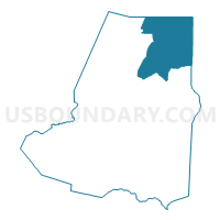
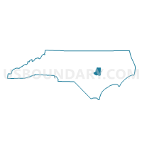
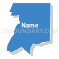
Voting District 02, Wayne County, North Carolina
About
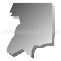
Outline

Summary
| Unique Area Identifier | 641815 |
| Name | Voting District 02 |
| County | Wayne County |
| State | North Carolina |
| Area (square miles) | 63.41 |
| Land Area (square miles) | 63.34 |
| Water Area (square miles) | 0.07 |
| % of Land Area | 99.88 |
| % of Water Area | 0.12 |
| Latitude of the Internal Point | 35.52387750 |
| Longtitude of the Internal Point | -77.89431210 |
Maps

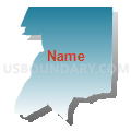
Graphs
Select a template below for downloading or customizing gragh for Voting District 02, Wayne County, North Carolina


Neighbors
Neighoring Voting District (by Name) Neighboring Voting District on the Map
- Voting District 01, Wayne County, NC
- Voting District 04, Wayne County, NC
- Voting District 05, Wayne County, NC
- Voting District 06, Wayne County, NC
- Voting District 07, Wayne County, NC
- Voting District BULL, Greene County, NC
- Voting District PRBL, Wilson County, NC
- Voting District PRST, Wilson County, NC
Top 10 Neighboring County Subdivision (by Population) Neighboring County Subdivision on the Map
- Stoney Creek township, Wayne County, NC (15,659)
- Saulston township, Wayne County, NC (7,676)
- Black Creek township, Wilson County, NC (4,087)
- Nahunta township, Wayne County, NC (3,608)
- Pikeville township, Wayne County, NC (3,138)
- Great Swamp township, Wayne County, NC (2,362)
- Stantonsburg township, Wilson County, NC (1,968)
- Shine township, Greene County, NC (1,780)
- Bull Head township, Greene County, NC (1,574)
Top 10 Neighboring Place (by Population) Neighboring Place on the Map
Top 10 Neighboring Unified School District (by Population) Neighboring Unified School District on the Map
- Wayne County Public Schools, NC (122,623)
- Wilson County Schools, NC (81,234)
- Greene County Schools, NC (21,362)
Top 10 Neighboring State Legislative District Lower Chamber (by Population) Neighboring State Legislative District Lower Chamber on the Map
- State House District 11, NC (78,345)
- State House District 10, NC (77,125)
- State House District 23, NC (75,657)
Top 10 Neighboring State Legislative District Upper Chamber (by Population) Neighboring State Legislative District Upper Chamber on the Map
- State Senate District 12, NC (210,500)
- State Senate District 5, NC (183,899)
- State Senate District 11, NC (177,074)
Top 10 Neighboring 111th Congressional District (by Population) Neighboring 111th Congressional District on the Map
Top 10 Neighboring Census Tract (by Population) Neighboring Census Tract on the Map
- Census Tract 1.01, Wayne County, NC (7,215)
- Census Tract 3.03, Wayne County, NC (6,326)
- Census Tract 3.02, Wayne County, NC (6,162)
- Census Tract 3.04, Wayne County, NC (5,198)
- Census Tract 9502, Greene County, NC (4,704)
- Census Tract 9, Wilson County, NC (3,716)
- Census Tract 2, Wayne County, NC (3,282)
- Census Tract 10, Wilson County, NC (1,753)